Unique 16th century map of Holy Land found in Germany

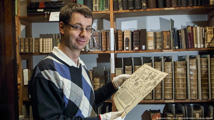
One of the pages of the twelve-page album “Map of the Holy Land” was found amongst the hundreds of vintage maps kept in the library. Until now, only two sheets of this 1540 masterpiece of Dutch artist Herman van Borculo had been found. One is located in the British Library, and the other in a private collection.
On the newly-found sheet are depicted places and scenes mentioned in the Bible, and illustrations of various stories from the Old and New Testaments and Church history. Inscriptions are made in Latin and Old Dutch.
Distances between cities and other important geographical parameters are not drawn to scale, as the map was not intended for navigation. Such maps, with Biblical illustrations, were typically a kind of pilgrimage diary.
Director of the university’s cartography division Martin Scheuplein notes that the “general” direction of the map is oriented to the north, with the top of the map showing the east, where the Holy Land and Jerusalem are located, as was typical of such sixteenth-century maps.
Among the scenes on the map are St. George’s saving of the princes from the dragon, and Jesus’ healing of the deaf and mute man. Among the cities depicted are Tripoli, in modern-day Lebanon, and Sepphoris, or Zippori, which in Biblical times was the chief town of Galilee.
The repository library of the Martin Luther University in the East German city of Halle keeps hundreds of different geographical maps, including ancient ones.
0
0
If you notice an error, select the required text and press Ctrl+Enter or Submit an error to report it to the editors.
Read also

Met. Longin’s lawyer: Judges wanted to ban video recording of the trial
01 November 21:29

OCU cathedral in Lutsk decorated with frescoes of businessmen
01 November 19:19

Court of Appeals returns Pochaiv Lavra skete to state ownership
01 November 07:24


